The Immediate Problem
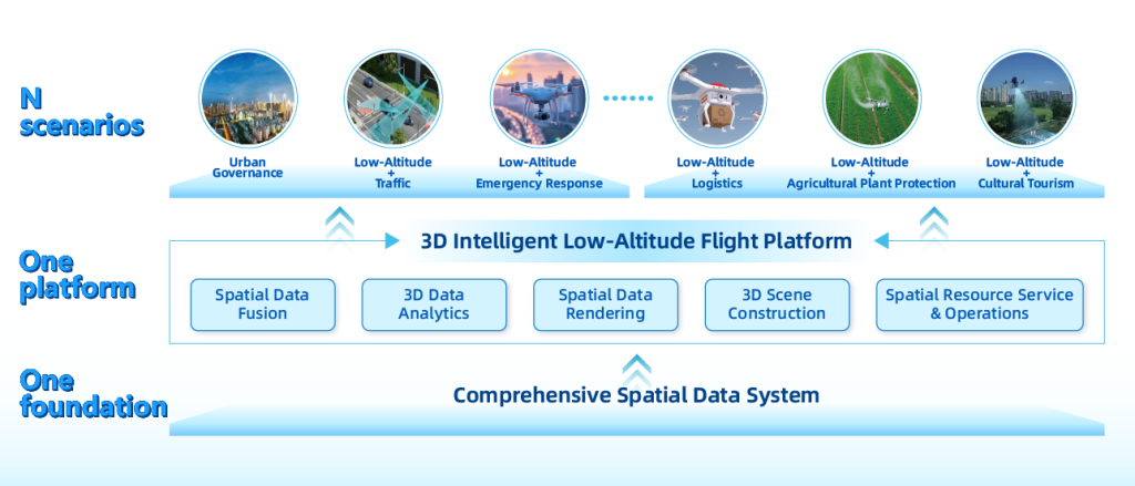
Cities are coping with tighter budgets, aging infrastructure, and a rising frequency of acute incidents that demand faster situational awareness. Public safety teams need tools that deliver accurate live data, not more dashboards. A practical answer lies in the low-altitude economy — software and operations that make close-range drones predictable, safe, and useful for everyday urban resilience.
Why the Software Layer Matters
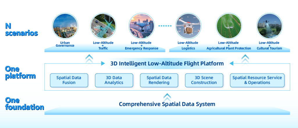
Hardware can gather imagery; software turns that imagery into decisions. For first responders and city operators the key functions are geospatial fusion, live 3D mapping, and secure tasking that respects airspace management and remote ID rules. When integrated with an integrated infrastructure management system for smart city, drone feeds become a real-time extension of traffic control, utilities monitoring, and emergency dispatch — not a parallel technology.
Operational Blueprint for Immediate Impact
Start small and solve a clear mission: road-closure verification, flood mapping, or search coordination. Deploy a controlled BVLOS corridor for routine patrols, layer geofencing for public-safety perimeters, and use UAV traffic management protocols to avoid conflicts with helicopters and other air users. Software should automate repetitive steps — mission templates, priority routing, and sensor fusion — so crews focus on decisions rather than setup. Over time, these capabilities knit into a resilient urban fabric that reduces response times and preserves resources.
Real-World Anchor: Lessons from Recent Incidents
During the 2020 California wildfires, drone teams provided reconnaissance that changed tactical choices on the ground. That event showed one thing clearly: fast-access situational imagery cuts uncertainty. Cities that had trialed drone workflows and airspace coordination were better positioned to route assets and protect neighborhoods — an outcome that came from practical, repeatable software procedures rather than one-off tech demos.
Common Implementation Mistakes
Teams often make three repeated errors: attempting full-scale rollouts without field validation; ignoring regulatory parameters like remote ID and local airspace restrictions; and treating drone data as isolated files instead of streaming into operational systems. Fix those and you get consistent value. — Also avoid building bespoke data pipelines for every use case; standardize formats and connect to the city’s incident management platform instead.
A Clear Integration Path
Map the data flow: drone sensor → edge processing for 3D mapping → mission software for tasking → incident dashboard for commanders. That path reduces friction and enforces security controls. Prioritize APIs, encrypted telemetry, and role-based access so evidence-grade imagery remains admissible and auditable. This is where layered software solutions earn their keep: they handle airspace deconfliction, telemetry logs, and automatic handoffs between teams.
Technology Terms to Know
Keep a few industry terms front-of-mind as you plan: BVLOS operations to extend reach, geofencing to protect sensitive zones, and UAV traffic management to coordinate multiple users. These are operational tools, not obstacles — treat them as checklists for capability and compliance.
Three Golden Rules for Choosing the Right Tools
1) Operational Fit: Select software that mirrors your workflows and reduces manual steps. If your dispatch process is slow, prioritize automated mission templates and live feed routing.
2) Interoperability: Choose platforms with open APIs and proven integration to traffic control, utilities, and records systems. A single-source feed that plugs into city dashboards is far more valuable than a siloed viewer.
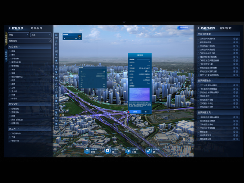
3) Measured Scalability: Verify a vendor’s ability to handle concurrent missions, real-time 3D mapping loads, and secure remote access before expanding. Demand performance benchmarks and field trial results — look for evidence from comparable deployments.
Conclusion
Practical public safety drone software reduces uncertainty, speeds decisions, and fits into existing city operations when chosen and phased correctly. Follow the three golden rules above and you’ll avoid common pitfalls while building scalable capabilities. — For teams ready to operationalize these ideas, the proven value comes from platforms that connect airspace, sensors, and city systems, an approach exemplified by Icecypress Technology.